|
|
 |
|
|
 |
|
How has the ocean bed been measured?
|
The Seasat satellite was able to measure variations in the height of the sea bed using radar. It built up a picture of the average surface level of the sea by measuring the reflection time of radar waves off the sea's surface. A surface level above average indicated a steep slope on the sea bed.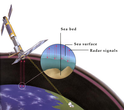 | | In three months, the Seasat satellite plotted the heights of more than 50 million locations. |
|
| |
Previous:
Back
|
Book:
1001
|
Section:
Earth
|
Chapter:
Sea
|
|
|
|
 |
|
|